
Of the many variables which can affect trip planning, one of the most crucial is the meteorological outlook. Constantly fluctuating weather conditions can impact route planning, disrupt schedules, and in extreme cases may even prevent a flight from taking place at all. Fog is one such weather feature. Here we will look at fog and aviation, focusing on the different types of fog and their potential impact on flight operations.
What is Fog?
Fog consists of visible water droplets or ice crystals suspended in the air, close to the Earth’s surface. It can be considered a type of low-lying cloud, which occurs when the temperature becomes close to the dew point (the temperature to which air must be cooled to become saturated with water vapor). Fog forms when the dew point rises until it equals the temperature, or the temperature lowers to the same as the dew point.
Both fog and mist have a significant impact on visibility, which in turn can affect aviation operations. Mist is less dense, consisting of smaller water particles which do not fall earthward. It is encoded as BR on Meteorological Terminal Air Reports (METAR) and Terminal Aerodrome Forecast (TAF) reports for visibility levels of 5/8 mile or greater.
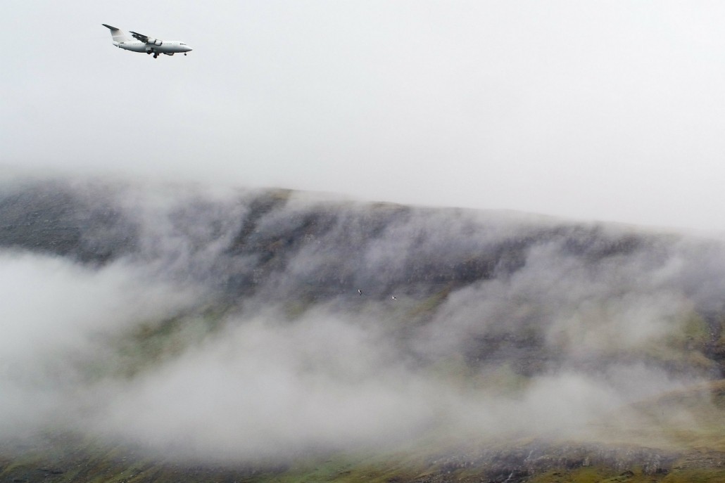
Aircraft landing at Vágar Airport, Faroe Islands. Coastal areas tend to be affected by advection fog.
Different Types of Fog
Radiation fog is caused by cooling of the earth’s surface, and can have a big impact on aviation operations. This type occurs only at night, and over land. In most cases, the fog will be thickest at night and dissipates through the morning. It may start to form again soon after sunset. Radiation fog is frequently found throughout Europe during winter, when the nights are longer and the temperature drops.
Advection fog develops in one region, and is then carried by wind currents to a different location. This type usually occurs along coastlines. Advection fog can last for days, and therefore can affect aviation operations more than radiation fog. Advection fog mainly affects airfields located near the sea, and occurs during spring when temperatures fluctuate rapidly. Hotspots for this type include the east coast of America, the Canadian Maritimes, the northeast coast of Russia, and Japan.
Upslope fog occurs due to the cooling of rising air. This generally happens when warm moist air is forced up a slope by the wind. Upslope fog often affects mountainous areas, such as the Rocky Mountains in Colorado.
Frontal fog appears in conjunction with the frontal surface of a colder air mass, due to the evaporation of falling rain. Stationary warm frontal fog has the biggest impact on aviation operations, as it can happen in any part of the world when the required weather conditions are present.
Freezing fog occurs when the air temperature falls below freezing. It is indicated by the descriptor FZ on METARs and TAFs. If the fog is very dense, it can cause ice to form on aircraft surfaces. A more severe type known as ice fog can appear in very cold temperatures (less than -30⁰C / -22⁰F). This is composed of ice crystals, and tends to occur mainly in polar air regions.
Predicting fog
Fog conditions tend to be transient, and can have rapid variations in density. Forecasters are usually able to predict the potential for fog based on the prevailing meteorological conditions. It can be more challenging, however, to accurately predict the impact on visibility.
A number of resources are available to flight crew to indicate current and predicted fog conditions. It is important for crews to have an understanding of how to read the information portrayed on charts and weather briefs. This helps when it comes to planning for how to deal with a fog event taking place on your route.
Impact of Fog
Weather conditions can potentially delay a flight or to cause it to be diverted from the planned destination airport. Fog has the ability to limit surface visibility to less than 5/8th mile, which can have a significant impact on operations. This often reduces aircraft arrival/departure flow rates, and in extreme cases can even cause the temporary closure of an airfield.
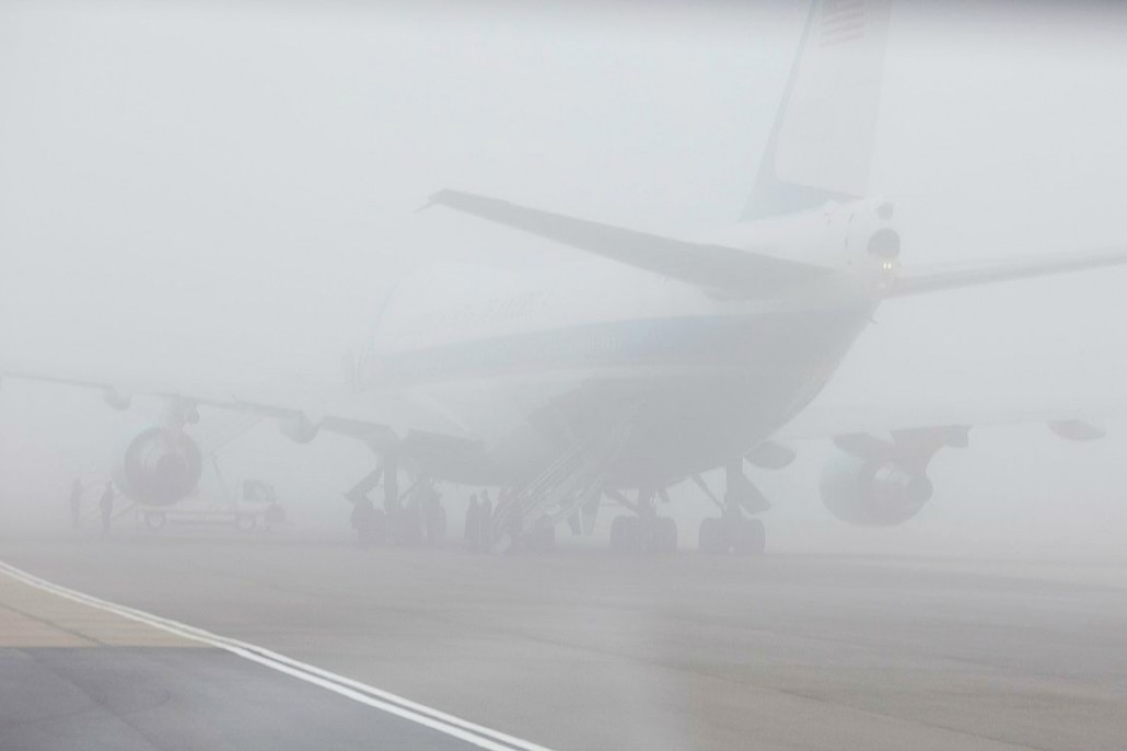
The image above shows thick fog obscuring visibility at London’s Stanstead Airport. Under these conditions, take-offs may have to be delayed.
If fog is causing disruption, crews may need to consider landing at an alternative airport. It is therefore important to carry additional fuel, in case of diversions or delays to scheduled landing times. Rapid reductions in visibility can necessitate a switch from Visual Flight Rules (VFR) to Instrument Flight Rules (IFR) within minutes. These quick changes mostly occur with advection types of fog (along coastlines or in upslope conditions). Radiation fog tends to form more gradually, as temperature lowers towards the dew point over time.
Fog presents both safety and cost issues for operators. Statistics for general aviation accidents in the United States from 1982 to 2013 indicate fog was associated with 40% of all fatalities within the ceiling, visibility, or precipitation-related category (source).
Diversions
Air Traffic Control (ATC) services may require crew to include designated alternate destinations on dispatch releases. This applies if the observed (or forecast) ceilings and visibility at the destination airport are less than 600 meters and/or 4,800 meters, within one hour of the estimated time of arrival. If it is determined that a diversion is necessary, aircrews must select an airport that meets alternate minima requirements. Aerodrome Operating Minima (AOM) are criteria used by pilots to determine whether they may land or take off from any runway. AOM consist of two parts: one relating to the cloud base, and one relating to the visibility and/or Runway Visual Range (RVR). These are usually 120 meters and 1,600 meters, or 180 meters and 3,200 meters. Some smaller airports may require more stringent minima, up to 300 meters and 4,800 meters. Regulations specify that additional fuel must be carried to fly to not only the destination airport, but also to fly to and land at the most distant alternate airport. These requirements can add considerable costs and time to a trip.
Often, the aircraft is already on its approach to an airfield when the decision may be taken to divert. It is important to have suitable alternatives arranged prior to attempting to land. Fog depth and thickness can be transient and vary a great deal from moment to moment. Good weather briefs and preliminary weather reports obtained prior to take-off are excellent sources of information to help anticipate fog events. If poor visibility persists, operators may have to consider adjusting schedules according to the fog situation.
Weather Briefs and Charts
Fog forecasts can be found in the TAF section of a typical weather brief, and are also noted in weather depictions and surface forecast charts. The Runway Visual Range (RVR) section of METARs should be checked for the latest reported runway visibility and weather conditions.
Crews should also refer to general forecasts and Airmen’s Meteorological Information (AIRMETs), issued by the National Weather Service. Weather depiction charts are an excellent reference for areas of fog and stratus. Shaded regions on the chart indicate areas where Instrument Flight Rules (IFR) will be necessary. Surface charts can also be checked for indications of fog or low cloud.
Aviation weather charts should be consulted by crew for the latest meteorological information.
Satellite Imagery
Satellite imagery can be used to help forecast potential fog formations, or to check for areas where persistent fog is prevalent. The 3.9/10.7 micrometer channel is employed at night to depict presence of fog or low level stratus. During daytime, visual satellite imagery is the preferred tool for depicting areas of fog/low clouds. Rough estimates of the depth and extent of fog can be determined by Infra-Red (IR) channel differences, however surface and sounding reports remain more accurate indicators of actual fog depth. In cases where correlating surface reports are not available, IR imagery can be an effective alternative.
Other Sources of Information on Weather Conditions
The NOAA Aviation Weather Center website is a valuable resource for pilots and includes detailed information on worldwide fog and stratus development, as well as other weather conditions.
Still Have Questions About Fog? Consult Our Expert Team!
Climatic conditions are one of the most crucial and unpredictable aspects of flight planning. Jetex recognizes the importance of keeping you updated on any unexpected changes. We provide accurate, up-to-the-minute weather information, ensuring a smooth and safe flight for you and your crew.
Our dedicated trip planning team are experts in their field, and together share a wealth of experience. We have established state-of-the-art operations centers in Dubai, Miami and Beijing. All are fully staffed around the clock, and ready to cater to your needs in any area of the globe.
Contact us today on +971 4 212 4000 or email info@jetex.com.

